Subject: Houston, Texas
Period: 1963 (circa)
Publication:
Color: Printed Color
Size:
37.7 x 29.8 inches
95.8 x 75.7 cm
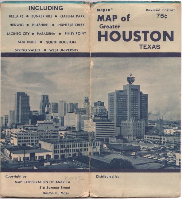
This large map of the city is brightly colored in the same style as the Ashburn series of maps from the 1950s. It extends to include the municipalities of Jacinto City, Pasadena, South Houston, Bellaire, and Bunker Hill. Details include roads, railroads, parks, cemeteries, airport, Rice Institute, University of Houston, and much more. A table at top right lists points of interest which are keyed to the map. The verso features an extensive street index. Folds into paper wrappers (4.0 x 9.0") featuring the Houston skyline. According to text on the inside front cover, the city's population at the time was 932,000. Published by the Map Corporation of America. We found only one institutional example for this map on OCLC.
References:
Condition: B+
A colorful example, issued folding, with several short splits at the fold junctions and minor loss at a few junctions. Paper wrappers have some light wear and abrasions, particularly along the spine.