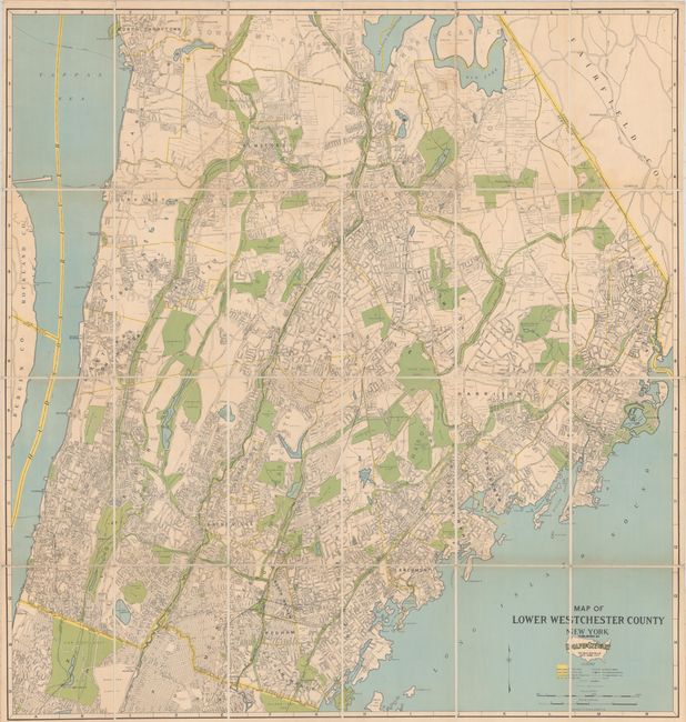
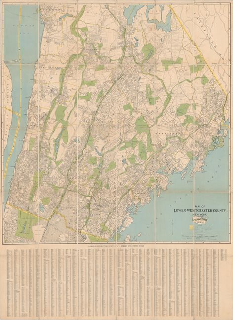
Subject: Westchester County, New York
Period: 1931 (dated)
Publication:
Color: Printed Color
Size:
34.1 x 35.9 inches
86.6 x 91.2 cm
This highly detailed map by Dolph & Stewart covers Westchester County from Tarrytown to just south of the border with New York City. Yonkers, Mount Vernon, New Rochelle, Rye, Scarsdale, and White Plains are among the places located. South of the New York City border, part of the Bronx, Van Cortlandt Park, and Woodlawn Cemetery are delineated. The map extends to show a sliver of New Jersey beyond the Hudson River and part of Connecticut in the northeast. The legend below the map identifies state, county, city or village, and town lines, streets, railroads and stations, transportations lines, and ferry routes. Below the map is an extensive street and avenue index. Parks and golf courses appear in green, bodies of water in blue. Full sheet with index measures 34.6 x 47.3". This example has been dissected and mounted on linen.
References:
Condition: B+
Issued folding, dissected and mounted on linen. There is minor toning along a few folds and a bit of foxing and soiling at top.