Catalog Archive
Auction 206, Lot 265
"Baye et Port d'Yorc Capitale de la Nouvelle Yorc", Bellin, Jacques Nicolas
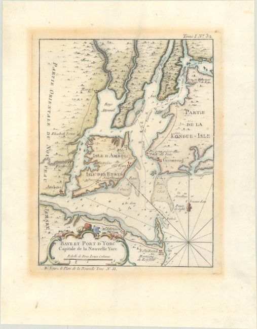
Subject: Colonial New York & New Jersey
Period: 1764 (circa)
Publication: Le Petit Atlas Maritime
Color: Hand Color
Size:
6.6 x 8.6 inches
16.8 x 21.8 cm
Download High Resolution Image
(or just click on image to launch the Zoom viewer)
(or just click on image to launch the Zoom viewer)