Subject: Aspen, Colorado
Period: 1960 (circa)
Publication:
Color: Printed Color
Size:
16.6 x 12.8 inches
42.2 x 32.5 cm
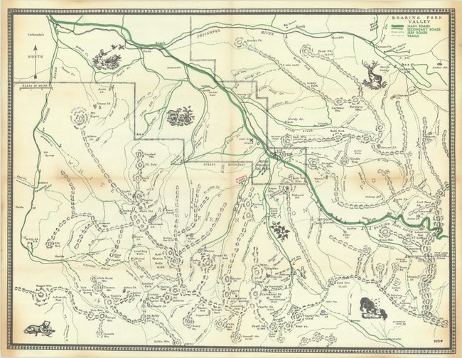
This is the only example we have been able to find of this elegant and nicely detailed map of western Colorado's Roaring Fork Valley. The map centers on Aspen and the White River National Forest, spanning from Fryingpan River south to the Elk Mountains. Several individual mountains and lakes are named. Main roads, secondary roads, jeep roads, and trails are indicated by varying green lines. The landscape is peppered with pictorial elements, including duck hunting, wildlife, and a ghost (to mark the Ashcroft ghost town). Attributed to an artist named Fritz at bottom right.
References:
Condition: B+
Issued folding with areas of light toning and a small manuscript marking in red pencil.