Subject: Eastern United States
Period: 1806 (circa)
Publication: General Atlas
Color: Hand Color
Size:
13.1 x 10.6 inches
33.3 x 26.9 cm
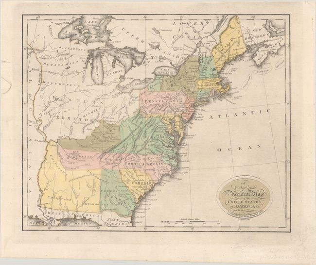
This scarce map comes from a later edition of the first general atlas published in Scotland. It appears to be based on Robert Wilkinson's A Map of the United States of America, with Part of the Adjoining Provinces from the Latest Authorities (1794) and covers the region from the eastern seaboard to the Mississippi River. Western Territory takes in all the area west of the Ohio River with several Indian tribes located within it. Kentucky occupies a loosely organized region west of Virginia. In present-day Tennessee, the North Carolina land grants of Cumberland and Holstonare located, extending North Carolina in an odd configuration. An unnamed territory in the region of Mississippi and Alabama is the tribal territory of the Chickasaws, Cherokees, Choctaws, and Muskogees. Main is noted as belonging to Massachusetts Bay. A 136 foot Niagara Fall is located, as is the Country of the Six Nations. Engraved by John Menzies.
References:
Condition: A
Full contemporary color on a sturdy sheet with a "D & AC" watermark, dated 1807.