Subject: United States, Aviation
Period: 1958 (dated)
Publication:
Color: Printed Color
Size:
36 x 24 inches
91.4 x 61 cm
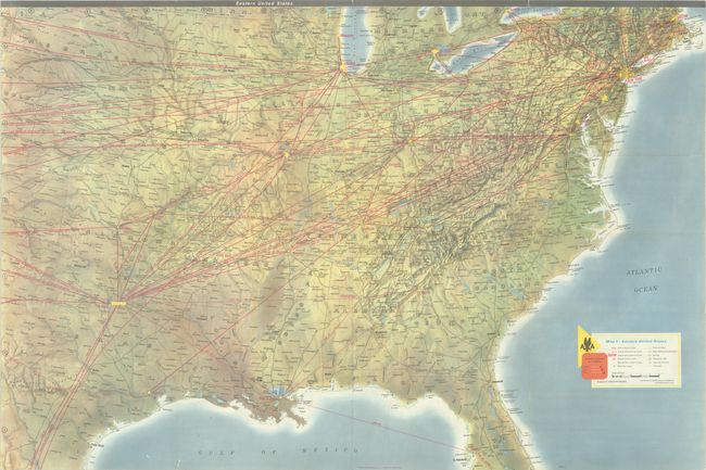
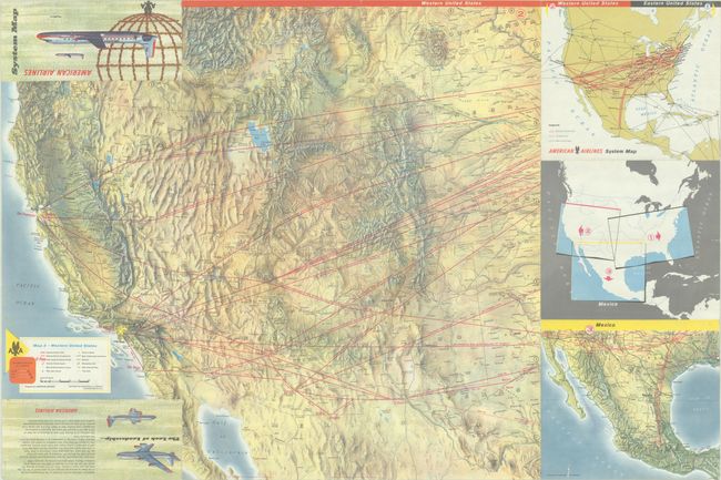
This two-sided map illustrates the American Airlines flight network in both the United States and Mexico. The recto details routes in the eastern United States, while the verso presents the western U.S. along with an inset of Mexico. Route distances are noted as are non-stop routes, including Los Angeles to New York (which was first achieved in 1953). A legend further identifies American Airlines airports, other airports, railroads, highways, metro areas in yellow, and more. Self-folds into pictorial wrappers.
References:
Condition: B+
Issued folding with a couple of short edge tears at bottom, a 0.5" tear adjacent to a fold in Nevada, and tiny losses at a couple of fold junctions.