Subject: United States
Period: 1939-43 (dated)
Publication:
Color: Printed Color
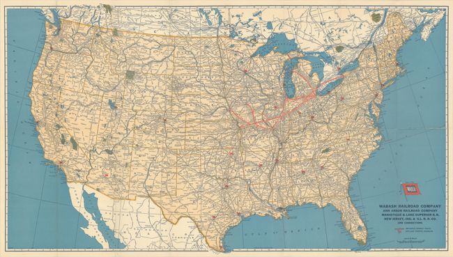
A. Wabash Geographically Correct Map of the United States, dated 1943 (28.9 x 16.4"). This colorful map of the United States emphasizes the Wabash Railroad and its connections with a bold red line that extends from Buffalo to Omaha. Red flags scattered across the landscape represent off-line traffic agencies. Folds into illustrated stiff paper covers (4.0 x 8.8"). Condition: Issued folding with an archivally repaired 3.5" fold separation at right and a small chip at a fold intersection at left. Map is laid into covers.
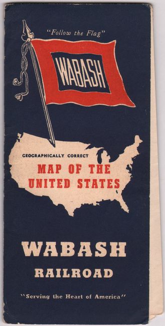
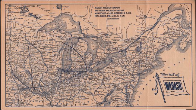
B. Wabash Railway Company Ann Arbor Railroad Company Manistique & Lake Superior R.R. Co. New Jersey, Ind. & Ill. R.R. Co. [in] "Follow the Flag" Wabash Time Tables Corrected to June 18, 1939, dated 1939 (15.4 x 8.6"). This interesting 22-page booklet of Wabash Railroad time tables includes a map of the Mid-Atlantic, New England, and the Upper Midwest with the railroad's route highlighted from Buffalo to Omaha. Self-folding into pictorial wrappers (4.0 x 9.0"). Condition: Lightly toned with minor chipping along booklet's top edge, not affecting map image.
References:
Condition: B+
See description above.