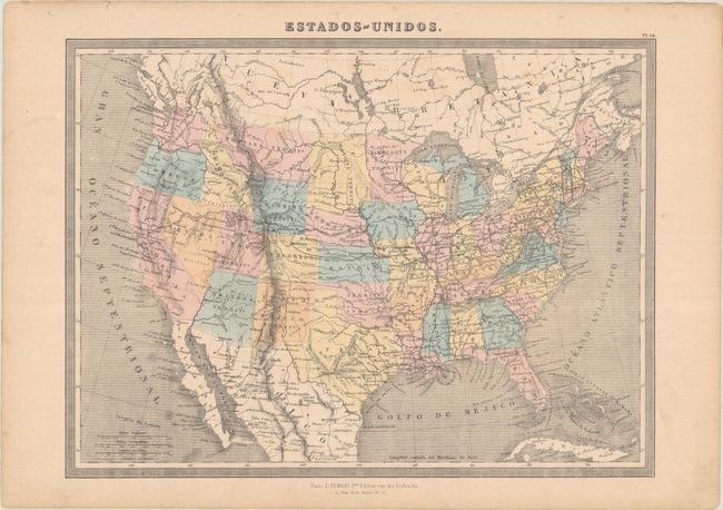
Subject: United States
Period: 1868 (circa)
Publication:
Color: Hand Color
Size:
14.6 x 10.8 inches
37.1 x 27.4 cm
This fascinating and scarce Spanish-language atlas map shows the territorial configuration of the American West in the aftermath of the Civil War. Wyoming Territory, created in 1868, is the latest addition. It is surrounded by the territories of Idaho, Montana, Dacota, Utah, and Colorado (not explicitly labeled as a territory here). Arizona Territory appears with Prescott as the capital. Despite becoming a state in 1858, Minnesota is still named as a territory. Nevada, Nebraska, and West Virginia appear as states. Published in Paris by L. Turgis Jne.
References:
Condition: B+
There is light soiling, a minute hole on map border at bottom right, and binding holes in the top blank margin.