Subject: United States
Period: 1834 (dated)
Publication:
Color: Hand Color
Size:
24.8 x 19 inches
63 x 48.3 cm
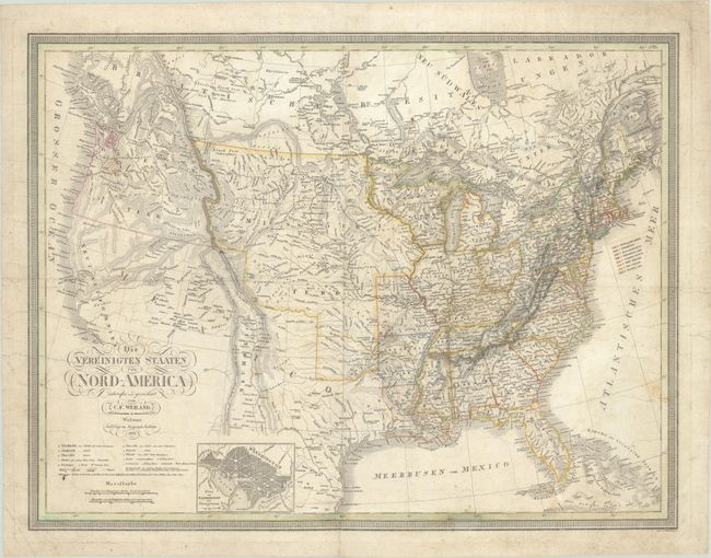
This large and uncommon German map shows U.S. development reaching west to Missouri, Arkansas Territory, and Louisiana with a huge Missouri Territory to its west. Beyond the Rocky Mountains is a large Oregon Territory with an undetermined northern border reflecting the boundary dispute with Britain (Canada). In the Great Basin, two fictitious rivers originate from Timpanagos and Teguayo lakes and flow into the Pacific. Mexico is in control of the Southwest and there is no mention of Texas. The interior is filled with rivers, mountains, and Indian tribes. A small inset plan of Washington is located along the bottom border. Published by the Geographisches Institut.
References:
Condition: B
Contemporary outline color with some soiling and extraneous creasing. There is a 3.5" tear along the center of the bottom border with some small loss that has been infilled with a small amount of image in facsimile. A few small wormtracks in Missouri/Arkansas have been closed on verso with archival materials. Issued folding.