Subject: Eastern United States & Canada
Period: 1799 (published)
Publication:
Color: Black & White
Size:
5 x 8.2 inches
12.7 x 20.8 cm
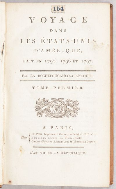
This is the first edition of Francois Alexander Frederic La Rochefoucald Liancourt's account of his travels in Canada and the United States. A supporter of the French monarchy, La Rochefoucald Liancourt fled to England and then the United States during the French Revolution. He spent 3 years in exile in North America and published an account of his experience upon returning to France in 1799. His work describes in detail the political constitution, natural history, physical geography, agriculture, and the customs of the inhabitants of the United States. Included in the volumes are the following three folding maps:
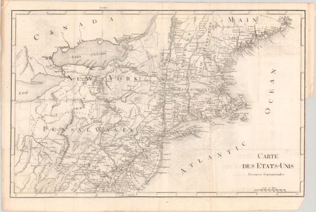
Carte des Etats-Unis Provinces Septentrionales (20.1 x 12.7"). This map covers all of the Northeast and Mid-Atlantic, extending south to below Alexandria and west to beyond Wheeling on the Ohio River. The entire map is in English with only the title in French. Early county development in Pennsylvania is current to 1794, prior to the organization of Greene and Lycoming counties. The Lands of the Six Nations appear in western New York beside Lake Erie. There is very good detail of roads and settlements throughout the region. Condition: Issued folding with light offsetting and a tiny binding tear at right. (B+)
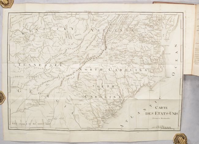
Carte des Etats-Unis Provinces Meridionales (20.1 x 13.6"). This interesting map covers all of the Carolinas with parts of Virginia, Kentucky, Tennessee and Georgia. Between Tennessee and Georgia is a long strip of land labeled "United States Territory." This land originally belonged to South Carolina but was ceded back to the United States in 1787. Numerous Indian villages are shown, especially in the region of present-day Alabama. Below Georgia is "Land Claimed by the United States" referring to the disputed region between the United States and Spain. Condition: Issued folding with just a hint of offsetting. (A)
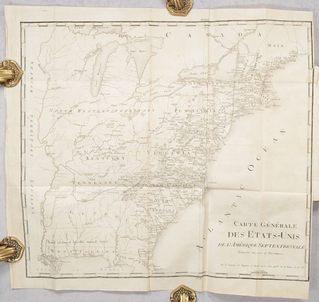
Carte Generale des Etats-Unis de l'Amerique Septentrionale Divisee en ses 17 Provinces (17.8 x 15.5"). This is the general map of Rochefoucald Liancourt's travels in the United States. It extends south to include West Florida and parts of East Florida. The western boundary of Georgia extends to the Mississippi River. The map shows the same U.S. claims as the map above along with early depictions of Kentucky, Tennessee and the Indiana Land Company in preset-day West Virginia. Above the Ohio River is a huge Northwest Territory and west of the Mississippi River is under Spanish control. Condition: Issued folding with some creasing along a vertical fold and a short binding tear in the right border. (B+)
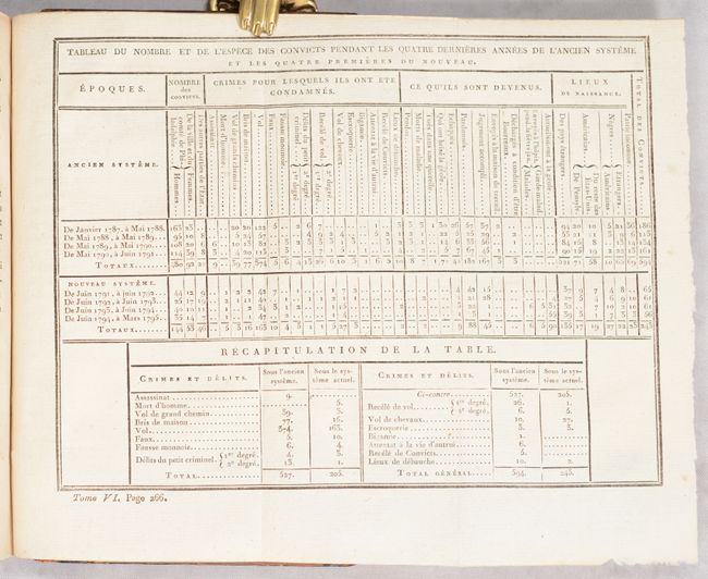
Also included are seven folding tables outlining the number and types of criminal convictions, the types and amounts of exports and imports between the United States and England, and several tables related to the functioning of the government of the United States and each individual state and territory. Octavo, 8 volumes: [24] 365; [6] 349; [6] 384; [6] 349; [6] 400; [6] 336; [6] 336; [4] 244. Hardbound in contemporary leather with gilt tooling and red leather title labels on spine.
References: Howes #L-106; Sabin #39056.
Condition: B+
See description for condition of maps. The first map is laid in the volume and the other two are still bound. Text is very clean with some occasional light toning. Bindings have some gouging along the joints and chipping near the head and tail of all the spines.