Subject: Colonial Eastern United States & Canada
Period: 1776 (circa)
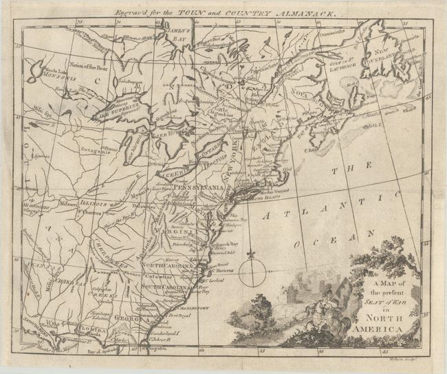
Publication: Toun and Country Almanack
Color: Black & White
Size:
9.4 x 7.6 inches
23.9 x 19.3 cm
This rare Revolutionary War-era map appears cartographically identical to the map of the same title published in Westminster Magazine in August 1776, but it features a compass rose and a more elaborate title cartouche, which features an anachronistic, Athena-like figure on horseback in front of the smoke and ruins of battle. The map spans from New Orleans to Newfoundland and extends west of the Mississippi. A road is delineated traveling up the coast from St. Augustine to Boston. West Florida extends to the Mississippi, and beyond the river there are familiar tribal names like Akansas and Missooris and the settlement Kansez. In Pennsylvania, Ft. du Quene or Pitsburg is located. "Engrav'd for the Toun and Country Almanack" by H. Gavin. This is the only example of this map that we have come across.
References: cf. McCorkle #776.21.
Condition: A
Issued folding, now flat, on a sheet with a fleur-de-lis watermark. There is a 0.5" binding tear at right that has been repaired with archival materials on verso. The left margin has been professionally extended and the binding trim at bottom right has been replaced.