Subject: North America
Period: 1868 (dated)
Publication: Kleiner Atlas
Color: Hand Color
Size:
16.9 x 13.3 inches
42.9 x 33.8 cm
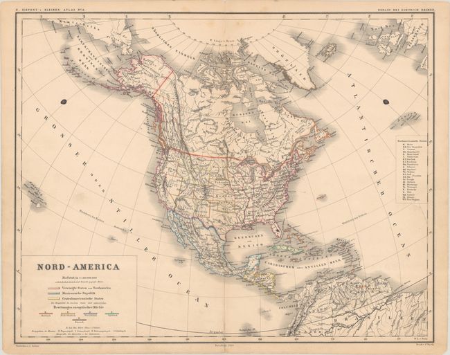
This map of North America utilizes a color-coded legend to identify the boundaries of the United States, Mexico, and Central American states. The European possessions in the Caribbean are also highlighted in various outline color. In the western United States, northwestern Wyoming Territory juts too far west while southern Idaho Territory extends too far east. Arizona Territory includes the southern tip of Nevada and Dakota is a single territory. Engraved by J. Sulzer.
References:
Condition: B+
Contemporary outline color with a pair of ink spots at left and right and short archivally repaired centerfold separations at top and bottom.