Subject: North America
Period: 1860 (dated)
Publication:
Color: Hand Color
Size:
61.7 x 65.8 inches
156.7 x 167.1 cm
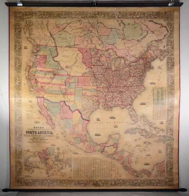
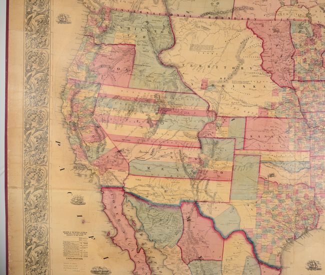
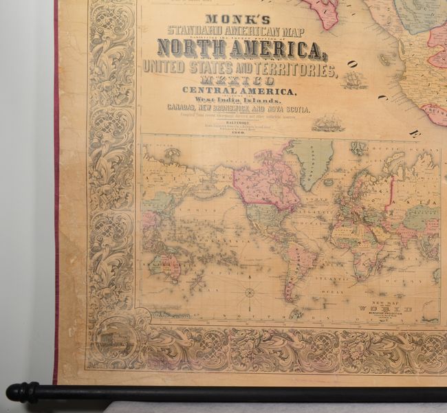
This majestic wall map, issued around the beginning of the Civil War, reflects the steady westward expansion of the 1850s following the land gains after the Mexican-American War. The middle of the country is occupied by Kansas Territory and the oversized Nebraska Territory, which stretches from the Missouri River to the Continental Divide. Utah and New Mexico territories are in their largest extents, the latter of which shows Arizona occupying its southern third. Washington Territory is shown in its inverted "L" shape including present-day Idaho, and development in the Pacific Northwest is mostly confined to west of the Cascades. Indian Territory is composed of three named areas: Chah-Lahkee, Muscogee, and Chata. Other details include several proposed railroads to the Pacific, the Overland Mail Route, forts, Indian tribes, and much more. The Poney Express, indicated by a dotted line, has been added to this edition. Surrounding the main map image is a table of distances and populations, a table of United States counties, and a large inset of the world on Mercator's projection. This spectacular wall map is embellished with decorative borders and numerous engraved sailing/steamships in the oceans. Drawn, engraved and printed by A. Hoen & Company in Baltimore. Original rollers present and intact.
References: cf. Wheat (TMW) #794; cf. Rumsey #5483.
Condition: B
This wall map has been professionally conserved with new linen backing and ribbon edging, and the original rollers are present and intact. The map image is very crisp with some light toning, cracking, and minor dampstaining. There are some chips, with some areas of engraved image replaced in facsimile, mostly in the map border at top. Some minor color offsetting appears in the lower border.