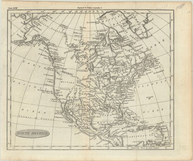
Subject: North America
Period: 1806 (circa)
Publication: Walker's Geography &c.
Color: Black & White
Size:
8.7 x 7.3 inches
22.1 x 18.5 cm
This attractive small map of North America shows the United States confined to east of the Mississippi River with East and West Florida to its south. Louisiana stretches from the Mississippi River west to the Rocky Mountains, and Spain is in control of the western United States. A River of the West is connected to a series of tributaries, suggesting a possible Northwest Passage. The place names Quivira and Teguayo dominate the west. To the north, Alaska is taking shape with a few islands shown at the end of the Aleutian Peninsula.
References:
Condition: A
A nice impression issued folding with minor toning along a fold.