Subject: North America
Period: 1797-1833 (circa)
Publication:
Color:
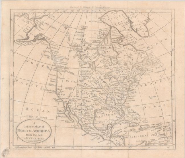
A. A General Map of North America from the Best Authorities, by (Rev.) Jedidiah Morse, circa 1797, black & white (8.8 x 7.4"). This small map of North America shows a mostly blank Great Basin and a long River of the West extending from the Entrance of Juan de Fuca eastward nearly to the Mississippi River. The map has good watershed detail, locates the source of the Mississippi River, and names some Indian tribes, forts, etc. Texas is located within the huge Louisiana Territory, but not delineated. Other interesting place names in the West include Quivira, Tecuayo, and New Albion. Engraved by Amos Doolittle. Published by Thomas & Andrews, Boston. Reference: McCorkle (18th C. Geography Books) #304-2. Condition: Issued folding, now flat and backed with archival tissue. There is faint toning and foxing and minor printer's ink residue. Remnants of hinge tape on verso.
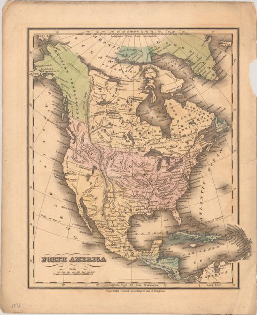
B. North America, by Eleazor Huntington, from Huntington's School Atlas..., published 1833, hand color (8.6 x 9.9"). This handsome atlas map names Texas and shows it under Mexican control along with California and the rest of the Southwest. Two vaguely delineated lakes are identified in the Great Basin: Timpanogos and Salado. The United States's claims extend north to the Queen Charlotte Islands and the border with Russian Possessions. In the northern reaches of Canada, the discoveries of Mackenzie, Franklin, Parry, and Ross are noted. Condition: Full contemporary color on a lightly toned sheet with light soiling and a chip in the right blank margin.
References:
Condition: B+
See description above.