Subject: North America
Period: 1785 (dated)
Publication: The Geographical Magazine...
Color: Hand Color
Size:
10.5 x 7.5 inches
26.7 x 19.1 cm
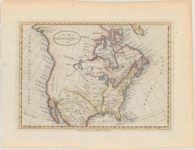
This handsome and uncommon map of North America was published in William Fordyce Mavor's The Geographical Magazine; or, A New, Copious, Compleat and Universal System of Geography..., published by Harrison & Co. The young United States is shown extending to the Mississippi, with notable towns and cities named. Florida is divided into West and East Florida, with the tip of the peninsula fragmented into a series of small islands. The Great Lakes are all connected. A vast Louisiana Territory takes up the middle of the present-day United States, and the American Southwest is labelled New Mexico. Baja California is identified, and the west coast is called New Albion. The northwestern part of the continent is largely left blank.
References: McCorkle (18th C. Geography Books) #268-Vol II [19].
Condition: A
A crisp impression on a clean sheet with a tiny paper flaw in an unengraved area in Canada that has been backed on verso. Issued folding.