Subject: Western Hemisphere - America
Period: 1820 (dated)
Publication:
Color: Hand Color
Size:
29.8 x 20.8 inches
75.7 x 52.8 cm
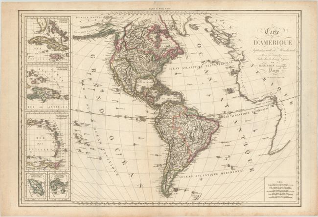
This uncommon French map of the Americas is boldly engraved to show the topography, much of which is spurious - making it all the more interesting. Alaska is still a bit misshapen and an imaginary Northwest Passage is lightly engraved through the Canadian Arctic. In the western part of North America the Rocky Mountains radiate out from a central point in present-day Wyoming. The boundary between Canada and the United States reflects U.S. claims into British Columbia and an interesting British presence labeled Nouvelle Albion is shown in California. A panel of inset maps provide a detailed view of the West Indies.
References:
Condition: B+
A dark impression in contemporary outline color, printed on heavy paper, with minor foxing and a bit of soiling. The map has been stored rolled and does not lay flat on its own.