Subject: Exploration & Surveys, George Anson
Period: 1748 (published)
Publication:
Color: Black & White
Size:
8.2 x 10.1 inches
20.8 x 25.7 cm
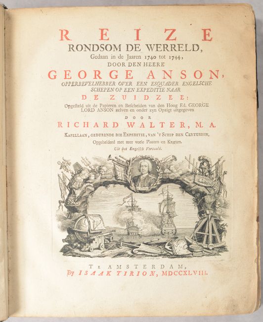
This is the Dutch edition of Anson's work describing his voyage around the world. In 1740, George Anson set sail in command of a squadron sent to attack Spanish possessions and interests in South America. The expedition was ill-equipped and failed to carry out its original ambitious mission. By June 1741 when Anson reached Juan Fernandes, his force had been reduced to only three of the original six ships, while the strength of his crews had fallen from 961 to 335. After launching several attacks on the west coast of South America and recuperating on the island he collected the remaining survivors on his flagship, the Centurion, and set sail in search of one of the richly laden galleons that conducted the trade between Mexico and the Philippines. The indomitable perseverance he had shown during one of the most arduous voyages in the history of sea adventure gained the reward of the capture of an immensely rich prize, the Nuestra Señora de Covadonga, which he encountered off Cape Espiritu Santo on June 20, 1743. From here he sailed back to Canton before traveling through Southeast Asia and around the southern tip of Africa. He made his way back to England, arriving in Spithead in June 1744.
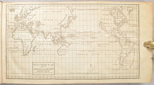
This edition includes 34 plates (14 maps and 20 views) called for in the list of plates along with a folding world map at the beginning of the volume. Of particular interest are the following three large folding maps:
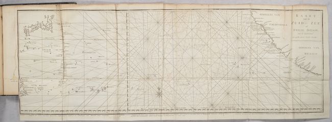
Kaart van de Zuid Zee of Stille Oceaan. (33.2 x 11.3"). This unusual chart joined on two sheets details the route of Spanish galleons between the Philippines and Acapulco. The tracks of British Navy Commodore George Anson and Spanish Nostra Seigniora de Cabadonga are shown. A somewhat speculative depiction of the islands of Japan is shown at top left.
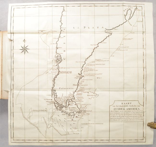
Kaart van het Zuidelykste Gedeelte van Zuider Amerika... (18.7 x 19.4"). This handsome chart shows the route of Capt. George Anson's expedition from St. Catherine's Island off the coast of Brazil, around Cape Horn and up to Juan Fernandes Island (now known as Robinson Crusoe Island) off the coast of Chili. The chart shows ocean currents and includes navigational notes. A decorative compass rose with fleur-de-lys is positioned in the sea.
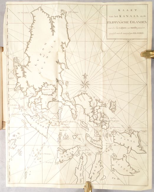
Kaart van het Kanaal in de Filippynsche Eilanden... (16.1 x 20.9"). This chart of the Philippine Islands spans from Luzon to Leyte. The focus of the chart is on the track of the Manila Galleon from Cavite until it is clear of land, north of Samal.
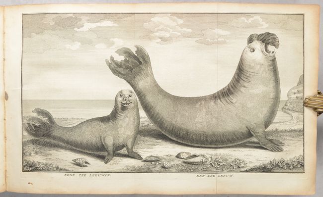
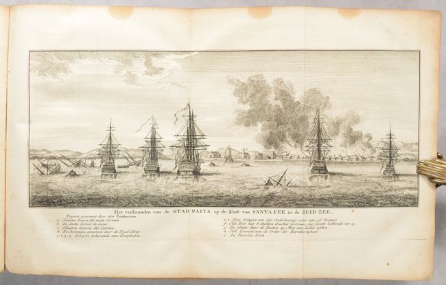
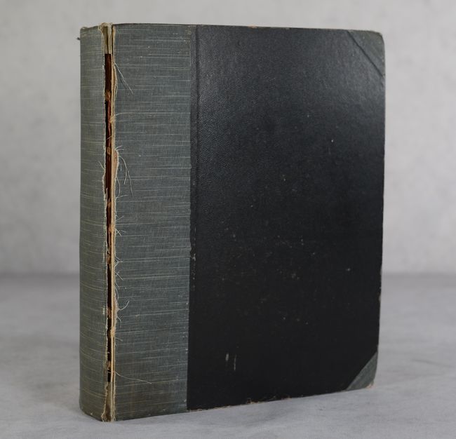
The remaining plates include coastal views, naval battles, land views, and an interesting plate depicting a pair of sea lions. 386 pages. Published by Isaac Tirion in Amsterdam. Hardbound in modern cloth over stiff paper boards.
References: cf. Shirley (BL Atlases) G.ANS-1a; Mercator's World Nov/Dec 1998 pp. 45-51.
Condition: B
The maps and views are overall good to very good with some light toning primarily along the sheet edges. The 3 large folding maps have some small tears and separations: South America has a 2" repaired binding tear at left and light offsetting; Manilla has two repaired binding tears at left extending 6.5" and 5" respectively; South Pacific Ocean has two archivally repaired 3.5" fold separations at top and some minor creasing. Text has light toning and soiling. Modern covers are starting and the spine backstrip is nearly detached.