Subject: Atlases
Period: 1830 (dated)
Publication:
Color: Hand Color
Size:
11.2 x 14.3 inches
28.4 x 36.3 cm
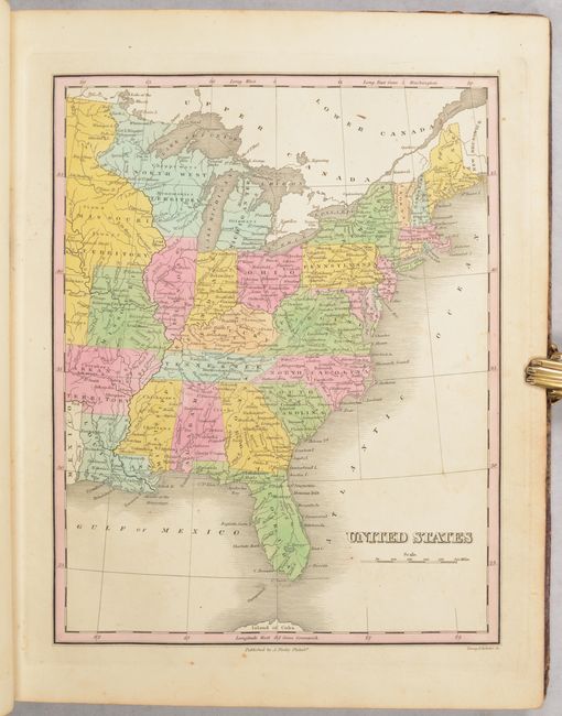
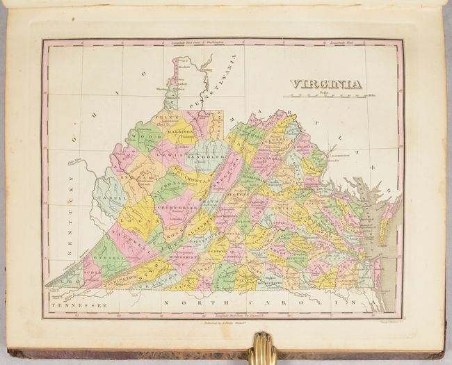
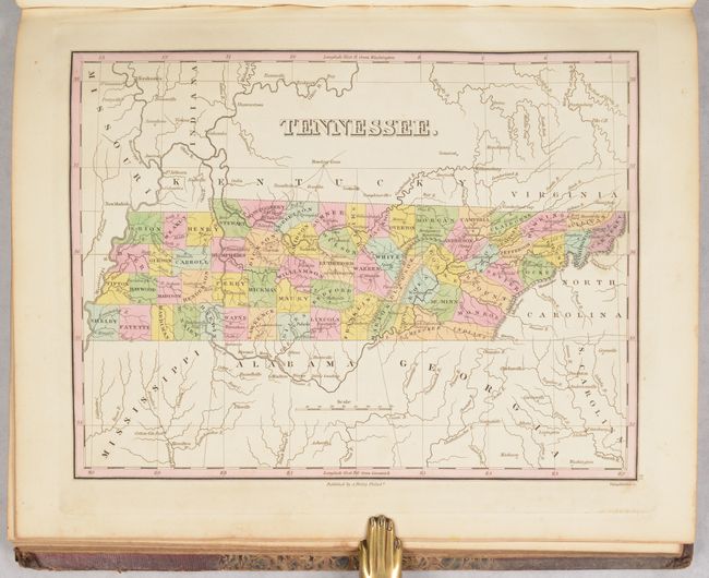
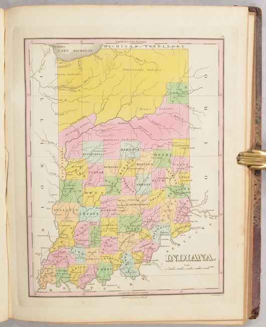
This important early American atlas contains all 58 called for maps as well as 2 thematic charts. Finley's General Atlas was very popular with the public and went through several editions from 1824-36, outselling rival atlases by Carey & Lea and H.S. Tanner. His maps were printed on high quality paper and employed an elegant engraving style with extensive topographical information that were routinely corrected and updated. Of particular interest in this edition are the maps of the trans-Appalachian west where settlements were rapidly developing on the frontier including:
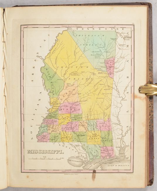
Mississippi. A handsome map of Mississippi that details the county seats, roads, towns and settlements, and watersheds. Development is primarily in the southern and western portion of the state, and mostly along the rivers. The northern half of the state is in the possession of the Choctaw and Chickasaw Indian tribes, with Monroe County being the exception where Cotton Gin Port is located. The early U.S. government built a cotton gin here in 1801 as part of a "plan of civilization" for the Chickasaw Indians. Three missionary stations are located; Monroe in Chickasaw territory, and Elliot and Mayhew in Choctaw territory. The Old Natchez Road, Robinson Road and Jackson's Road are located, along with several new roads in the south.
Indiana. Fine early map of the state with development confined to the southern half of the state. The top third of the state is unorganized beyond the Wabash River except for Allen County and consists of lands for the Delaware, Kickapoo, Ottaway and Pottawatomie Indians. The detailed map shows the roads, towns and settlements with most of the settlements and roads in the lower third of the state.
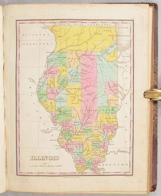
Illinois. In this map of the state, the lower two-thirds have been developed into counties, with the majority of settlement and wagon roads confined to the bottom third. Above the Indian Boundary line are lands reserved for the Sac, Fox and Winnebago Indian tribes. Chicago and Ft. Dearborn are noted just below the boundary line.
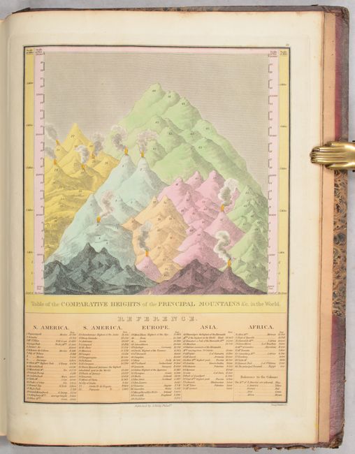
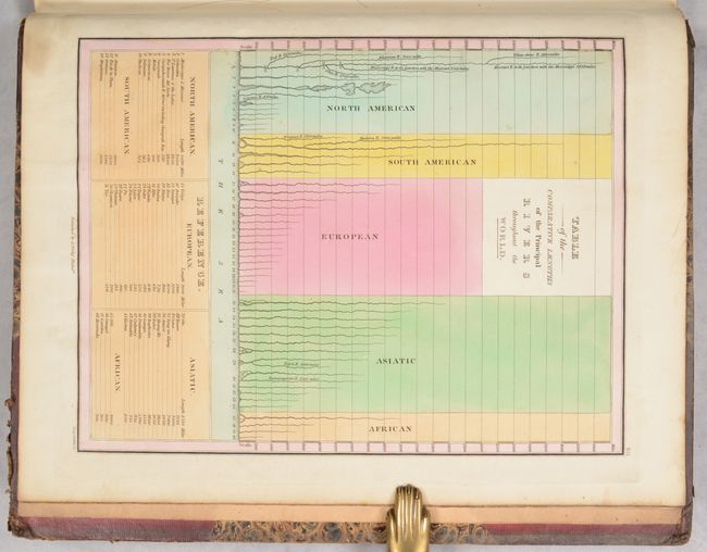
Also of interest is the map of the eastern United States which depicts large Missouri, Arkansas, and North West territories. At the back of the atlas are the thematic charts "Comparative Heights of the Principal Mountains" and "Comparative Lengths of the Principal Rivers." All maps were engraved by Young & Delleker and the ornate title page was lettered by Joseph Perkins. Title page, 58 maps, and 2 thematic charts. Table of contents page is missing. Hardbound in original quarter maroon leather with tips over marbled boards with a printed title label on front cover and gilt bands and titling on spine.
References: Phillips (Atlases) #755; Ristow, pp. 268-270.
Condition: B+
The maps are almost entirely very good to near fine with an occasional spot of foxing in the image and minor soiling in the margins. The double-page maps of New York and Pennsylvania are good (B) with light offsetting and 4" (NY) and 2" (PA) centerfold separations at bottom. The map of Mississippi has some minor staining along the bottom border. Text block is cracked in one place but still fully intact. Endpapers have previous owner signatures and a few manuscript drawings. Binding is in typical condition for this atlas with soiling, some scuffs/abrasions and wear.