Subject: Central Africa
Period: 1700 (circa)
Publication:
Color: Black & White
Size:
19.4 x 16.2 inches
49.3 x 41.1 cm
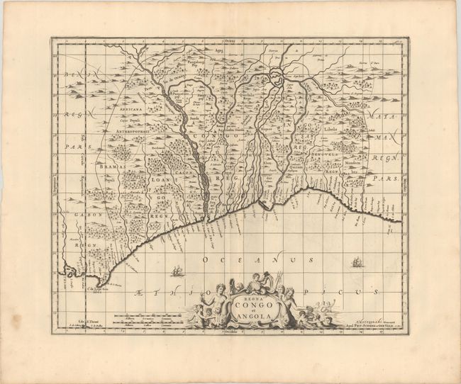
This striking map covers present-day Gabon, Congo, and Angola. It spans from Cape Lopez south to southern Angola, centering on the Congo River (also labeled as the Zaire River here). There are plenty of place names along the coast, including the cities of Soyo, Luanda, and Benguela. There is nice topographical detail inland, along with the names of several small kingdoms. A fragment of the Sao Tome coast appears at bottom left. Two sailing ships appear in the ocean. The bottom of the sheet is dominated by a decorative title cartouche depicting Neptune and a band of mer-folk. Petrus Schenk acquired the plate from Jansson's heirs and reissued the map with the imprint of his publishing partnership and with the addition of lines of latitude and longitude. Blank verso.
References: cf. Van der Krogt (Vol. I) #8755:1.
Condition: A
A sharp impression with a hint of offsetting and marginal soiling.