Subject: Africa
Period: 1769 (dated)
Publication:
Color: Hand Color
Size:
25.9 x 18.9 inches
65.8 x 48 cm
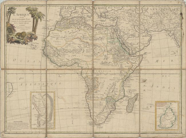
This large and uncommon copper-engraved map of the continent shows the extent of European geographical knowledge in the mid 18th century. While mostly accurate, it does have remnants of fantasy such as the twin lake source of the Nile in the Montagnes de la Lune, which in this depiction is quite a bit north of the Equator. The map includes insets of the Cape of Good Hope and Reunion island. The pictorial title cartouche features a lion. The map is dissected and backed on linen.
References:
Condition: B
There is moderate soiling, light toning, and an abrasion in the Indian Ocean. The edges of the dissected pieces are worn, and there are holes in the linen at the fold intersections. The corners of the sheets are a bit chewed up from previous pin holes.