Catalog Archive
Auction 205, Lot 605
"An Accurate Map of the East Indies Exhibiting the Course of the European Trade Both on the Continent and Islands. Drawn from the Best Modern Maps and Charts...", Bowen, Emanuel
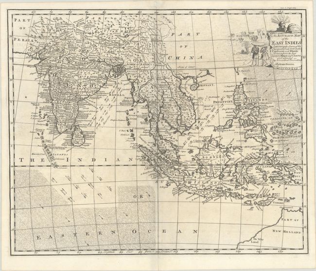
Subject: Southern & Southeast Asia
Period: 1744 (circa)
Publication: John Harris' Navigantium Atque Itinerantium Bibliotheca...
Color: Black & White
Size:
17.9 x 14.6 inches
45.5 x 37.1 cm
Download High Resolution Image
(or just click on image to launch the Zoom viewer)
(or just click on image to launch the Zoom viewer)