Catalog Archive
Auction 205, Lot 59
Prohibition-Era Map Highlighting the Highs and Lows of Alcohol Consumption
"Map Showing Isle of Pleasure"
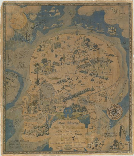
Subject: Cartographic Miscellany, Fictional Map
Period: 1931 (dated)
Publication:
Color: Printed Color
Size:
17 x 19.8 inches
43.2 x 50.3 cm
Download High Resolution Image
(or just click on image to launch the Zoom viewer)
(or just click on image to launch the Zoom viewer)