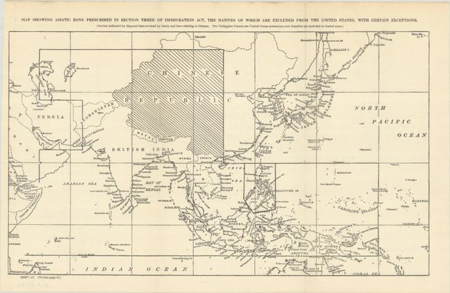
Map Documents Racist Immigration Law to Protect U.S. Against "Yellow Peril"
"Map Showing Asiatic Zone Prescribed in Section Three of Immigration Act, the Natives of Which Are Excluded from the United States, with Certain Exceptions...", U.S. Government
This small folding map was included in a government report related to the U.S. Immigration Act of 1917. Despite President Wilson's veto, the Immigration Act was overwhelmingly passed by Congress which excluded immigration from a specific geographically defined “Asiatic Barred Zone.” This zone, defined by latitudinal and longitudinal coordinates, extends from the Caspian Sea to the Solomon Islands, but excludes the Philippines (a U.S. possession at the time) and Japan. Countries barred included India, Afghanistan, Arabia, Burma, Siam, the Malay States, Dutch East Indies and most Polynesian Islands. Chinese immigration had already been excluded by a previous act (1882). The passage of the Immigration Act was a reflection of growing public concern promoted by media of the dangers to American life and culture of the “Yellow Peril.”
This map starkly reflects the immigration policy enacted over 100 years ago and documents a chapter in the country’s continuing struggle to deal with immigration. Click here to read the complete 1917 Act.
References:
Condition: B+
Issued folding on a clean sheet with a couple of short archivally repaired fold separations along the left fold.