Subject: Holy Land
Period: 1803 (published)
Publication: The Chronology and History of the World
Color: Black & White
Size:
22.6 x 16.7 inches
57.4 x 42.4 cm
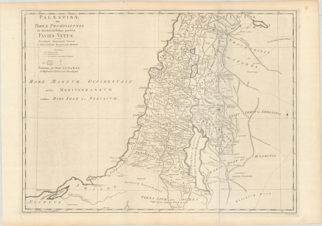
This handsome map depicts the twelve tribes of Israel and the kingdoms of Judea and Israel. It provides considerable detail including mountain ranges, rivers, lakes, and innumerable cities, villages, and other place names. Royal cities are identified using a crown symbol, while the Levitical and refugee cities identified with other special symbols. Places not found in scripture are identified by special underlining. Engraved by John Bayly.
Blair's Chronology went through many editions well into the 19th century with maps added in the 1768 and later editions to help illustrate lands covered by the work, both ancient and modern. Through the years, most maps show little or no revision between the various editions, especially the ancient maps.
References: cf. Shirley (BL Atlases) G.BLAI-1a #1.
Condition: B+
Issued folding on watermarked paper ("Portal & Bridges 1801") with faint offsetting and one tiny hole in the center of the image. There is a small ink spot adjacent to the right border.