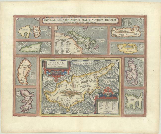
Subject: Cyprus & Aegean Islands
Period: 1584 (dated)
Publication: Theatrum Orbis Terrarum
Color: Hand Color
Size:
18.7 x 14.3 inches
47.5 x 36.3 cm
This handsome sheet is centered on a large map of Cyprus with a delicately engraved sea and two strapwork cartouches. The map of Cyprus is a reduced size version of Ortelius' earlier map of the island, with place names and their locations updated based on ancient sources, including Ptolemy and Strabo. The map is surrounded by 9 smaller maps of Greek Islands: Chios, Rhodes, Icaria, Rinia & Delos, Evia (Euboea), Samos, Kea, Lesbos, and Limnos. Latin text on verso, published in 1595.
References: Stylianou #67; Van den Broecke #216; Zacharakis #1619.
Condition: A
A sharp impression on a bright sheet with the crossed arrows watermark commonly found on Ortelius maps. There is minor marginal soiling and a professionally repaired centerfold separation at bottom, entering less than 1 cm into the image.