Subject: Sicily, Italy
Period: 1702 (circa)
Publication:
Color: Hand Color
Size:
21.5 x 17.6 inches
54.6 x 44.7 cm
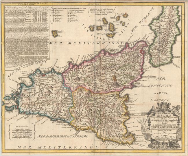
This graphic map of the island of Sicily extends to include a portion of the mainland as well as the Aeolian Islands, which are here called the Lipari Islands. It is filled with a wealth of interesting detail including rivers, mountains, towns, fortified towns, abbeys, churches, ancient ruins, and more. The most prominent features of the map are the large active volcano, Mt. Etna, and the fortified cities of Messina, Palermo, Catania and Syracuse. A panel of descriptive text fills the upper left corner while four distance scales occupy the lower left corner. Adorned by a decorative title cartouche surmounted by the coat of arms of Sicily.
References:
Condition: B+
A crisp impression on watermarked paper, issued folding. There is some minor creasing adjacent to the folds and a few small stains. Trimmed to the border at left by the binder along with an archivally repaired 1.5" edge tear.