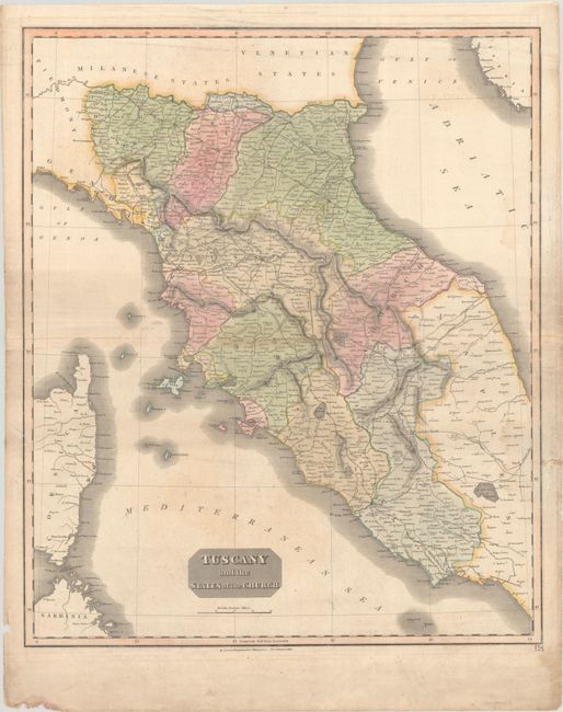
Subject: Central Italy
Period: 1814 (circa)
Publication: New General Atlas
Color: Hand Color
Size:
19.8 x 23.6 inches
50.3 x 59.9 cm
This handsome map is one of four regional maps of Italy in Thomson's beloved atlas. It spans from Parma south to Gaeta and identifies political boundaries, including the Papal States. Genoa, Modena, Bologna, Pisa, Florence, San Marino, Ancona, Rome, and several other towns and cities are named. Parts of Sardinia and Corsica appear at bottom left. There is excellent detail of roads throughout the region.
References:
Condition: B
Full contemporary color with light dampstaining and soiling, a section of toning along the centerfold, and minor extraneous creasing. A few short edge tears that enter the map image at left have been closed on verso with archival tape.