Subject: Northern & Southern Italy
Period: 1701 (circa)
Publication: A New Sett of Maps both of Antient and Present Geography
Color: Hand Color
Size:
14.2 x 18.9 inches
36.1 x 48 cm
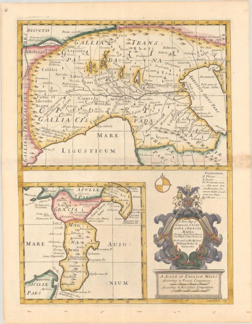
This handsomely engraved sheet features a map at top showing Cisalpine Gaul, an ancient region populated by Gauls in present-day northern Italy. It centers roughly on Mantua and extends from L. Lemanus (Lake Geneva) in the northwest to Pisa, Florence, and Siena in the south. A second map at bottom left depicts Magna Graecia, the Greek-speaking area of southern Italy, and the northern part of Sicily. Scylla and Charybdis are noted in the Strait of Messina. Both maps are filled with ancient place names and topographical detail. The bottom right corner is dominated by a compass rose and decorative cartouche that incorporates the title, two distance scales, and a dedication to William, Duke of Glocester. Engraved by Sutton Nicholls.
References: Shirley (BL Atlases) T.WELL-1a #16.
Condition: A
A sharp impression on paper with the watermarks of the Strasburg bend and lily and the initials "IDB." There is light toning along the centerfold that is almost entirely confined to the right blank margin.