Subject: Italy
Period: 1860 (circa)
Publication:
Color: Hand Color
Size:
15.4 x 18.6 inches
39.1 x 47.2 cm
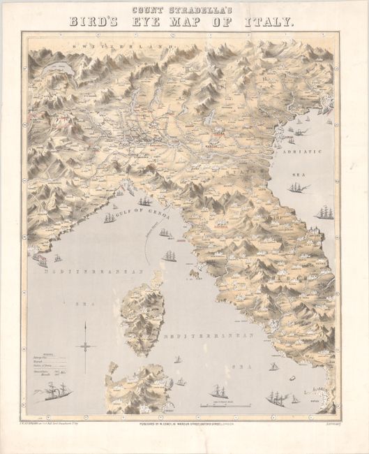
This is the first example we have come across of this rare map of Italy. It depicts the aftermath of the Second War of Italian Independence (1859), showing northern Italy split between Austria and the Kingdom of Sardinia, with the Papal States dominating central Italy. The map spans from the Italian-Swiss border south to Naples and the northern part of Sardinia. The map is distinguished by its charming pictorial elements, which include small architectural illustrations to mark towns and cities and several ships in the seas. A key identifies railways, telegraph lines, and the positions of the armies in the conflict. A rare and novel map showing Italy in the midst of its unification. Lithographed by T.W. Nicholson. Published by W. Coney in London, who also published an early comic map of Europe, The Evil Genius of Europe (ca. 1859), which depicts France as the "evil genius" trying to put on the "boot" of Italy.
References:
Condition: B
On a bright sheet with an edge tear that enters 9.5" into map image at top that has been closed on verso with archival materials. There is a bit of minor creasing at the top of the sheet and another archivally repaired edge tear that is confined to the bottom blank margin.