Catalog Archive
Auction 205, Lot 507
NO RESERVE
"[Lot of 2] I Governi d'Arcangelo e Bielo-Ozero con Parte del Governo di Novogorod [and] I Governi di Moscovia, di Niz-Novogorod e di Kazan", Carli, Pazzini
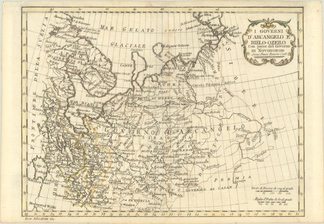
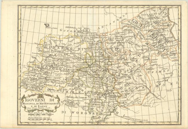
Subject: Russia in Europe
Period: 1789 (circa)
Publication: Atlante Geografico
Color: Hand Color
Size:
12.2 x 9.1 inches
31 x 23.1 cm
Download High Resolution Image
(or just click on image to launch the Zoom viewer)
(or just click on image to launch the Zoom viewer)