Catalog Archive
Auction 205, Lot 487
"Carte Generale des Treize Cantons Suisses et des Differents Etats de Leur Dependance; Ainsi que la Pluspart des Etats qui leur sont Voisins et Aliez; avec des Tables pour l'Intelligence de l'Histoire", Chatelain, Henry Abraham
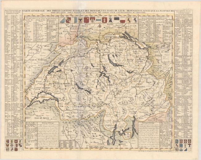
Subject: Switzerland
Period: 1720 (published)
Publication: Atlas Historique, Tome III
Color: Hand Color
Size:
24.5 x 18.6 inches
62.2 x 47.2 cm
Download High Resolution Image
(or just click on image to launch the Zoom viewer)
(or just click on image to launch the Zoom viewer)