Subject: Western Germany
Period: 1641 (circa)
Publication:
Color: Hand Color
Size:
19.5 x 14.8 inches
49.5 x 37.6 cm
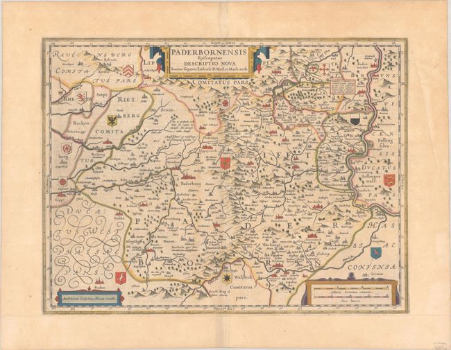
This fine map of the area around Paderborn in Westphalia was produced by Joannes Gigas (Gigante). It covers the region from the Weser River in the east, Warburg in the south, and reaches to Lippe in the west. Small coats of arms identify the gentry of the region and three decorative strapwork cartouches adorn the map. This was one of the plates that Blaeu obtained from the estate of Jodocus Hondius in 1629. Blaeu deleted Hondius' name and added his own to the imprint at lower left. German text on verso, published between 1641-70.
References: Van der Krogt (Vol. II) #2350:2.2.
Condition: B+
A nice impression with full contemporary color on a lightly toned sheet with a crease in the right margin and a light damp stain in the top margin. Remargined at bottom with old paper.