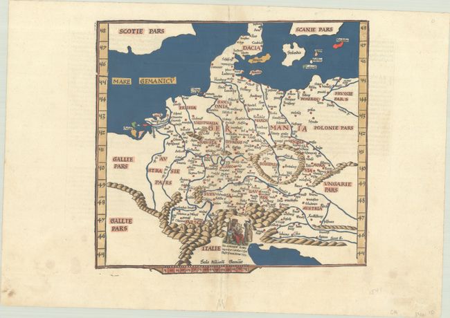
Subject: Central Europe, Germany
Period: 1541 (circa)
Publication: Claudii Ptolemaei Alexandrini Geographicae…
Color: Hand Color
Size:
12.8 x 12 inches
32.5 x 30.5 cm
This nice example of this "modern" map of Germany. Denmark and Scotland are still given their distorted Ptolemaic outlines. The woodcut maps from the blocks of Laurent Fries were based on the work of Waldseemuller. In this map, Fries has added a vignette of the Holy Roman Emperor, not included in Waldsemuller's model. Latin text on verso.
References: Mickwitz & Miekkavaara #211-32.
Condition: B+
A sharp impression with attractive modern color on a bright sheet with a bunch of grapes watermark. There is light toning along the centerfold, marginal soiling, and a short tear in the bottom margin. There are a number of small worm tracks along the centerfold that have been archivally repaired, with minor loss of image.