Catalog Archive
Auction 205, Lot 450
"Hispania", Linschoten, Jan Juygen van
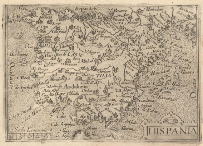
Subject: Spain & Portugal
Period: 1598 (dated)
Publication: His Discours of Voyages into ye Easte & West Indies
Color: Black & White
Size:
4.8 x 3.4 inches
12.2 x 8.6 cm
Download High Resolution Image
(or just click on image to launch the Zoom viewer)
(or just click on image to launch the Zoom viewer)