Subject: Belle Isle, France
Period: 1765 (circa)
Publication:
Color: Hand Color
Size:
16.8 x 14.1 inches
42.7 x 35.8 cm
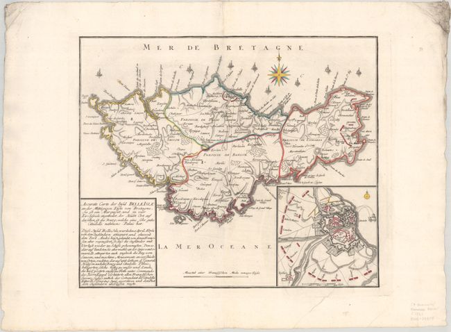
This rare map of Belle Isle was created after the British invasion of the island during the Seven Years' War. After a six-week siege, the British captured the citadel of Le Palais on 8 June 1761, and occupied the city until 1763, when the British ceded it to Menorca in accordance with the Treaty of Paris. The map shows the island divided into its four parishes (Le Palais, Bangor, Locmaria and Sauzon), and depicts the early settlements, roads, and topography. British ships are shown lining the northern coast of the island, and the positions of troops are shown surrounding the cities of Le Palais and Locmaria. A large inset map gives a more detailed view of the siege of Le Palais and the text at left summarizes the siege and occupation of the island.
References:
Condition: A
A dark impression with contemporary outline color on a bright sheet with a coat of arms watermark. There is a printer's crease at bottom right. The sheet is deckle-edged, with heavy soiling in the top corners, far from the map image. There is a canceled stamp from the Landesbibliothek Coburg on verso.