Catalog Archive
Auction 205, Lot 438
"Ducatus Turonensis Perlustratus et Descriptus ab Isaaco Franco, Aedili Regio, et in ea Provincia Viarum Magistro. Touraine", Blaeu, (Family)
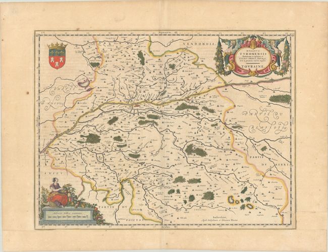
Subject: Central France
Period: 1641 (circa)
Publication:
Color: Hand Color
Size:
19.7 x 15 inches
50 x 38.1 cm
Download High Resolution Image
(or just click on image to launch the Zoom viewer)
(or just click on image to launch the Zoom viewer)