Subject: Northern France
Period: 1641 (circa)
Publication:
Color: Hand Color
Size:
19.7 x 15.1 inches
50 x 38.4 cm
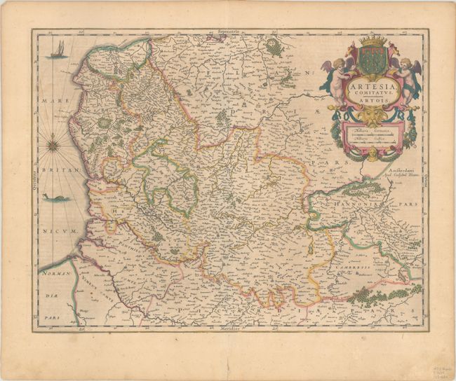
A very decorative map depicting the northern province of Artois on the border with Belgium. The map is fully engraved with forests, rivers, bridges, cities and villages. A fishing boat, sea monster and compass rose grace the sea and a spectacular, garlanded title cartouche with the regional coat of arms completes the map. German text on verso, published between 1641-70.
References: Van der Krogt (Vol. II) #3300:2.
Condition: B+
A nice impression with full contemporary color on a lightly toned sheet with an old repair to a centerfold separation at bottom, well away from map image.