Subject: Low Countries
Period: 1635-43 (circa)
Publication: Toonneel des Aerdrycks...
Color: Hand Color
Size:
20.9 x 16.5 inches
53.1 x 41.9 cm
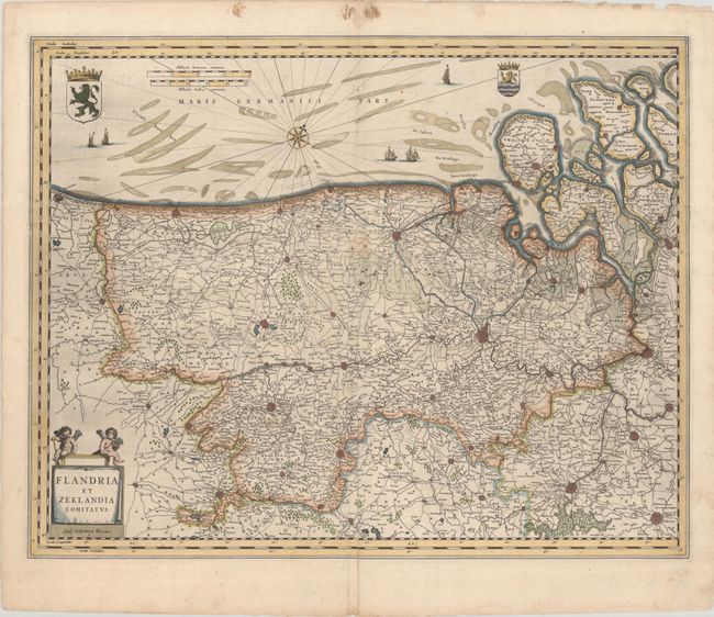
This intricately detailed map extends from Calais, France through Flanders to Zeeland in southwestern Netherlands. The map is filled with towns, fortified cities, forests, marshes, and the many islands that make up Zeeland. Locates Dunkirk, Bruges, Brussels, Antwerp, Middleburg, and many more. The North Sea is filled with shoals, sailing ships, and coats of arms for both Flanders and Zeeland. A pair of cherubs sit on a bench overlooking a banner-style cartouche at bottom left. Dutch text on verso, published between 1635-43.
References: Van der Krogt (Vol II) #3200:2.
Condition: B+
A crisp impression with a faint stain along the middle centerfold and an archivally repaired 3.5" centerfold separation at bottom. There is some light staining and minor chipping in the top blank margin.