Subject: Northern Netherlands
Period: 1643 (circa)
Publication: Theatre du Monde ou Nouvel Atlas
Color: Hand Color
Size:
19.4 x 15 inches
49.3 x 38.1 cm
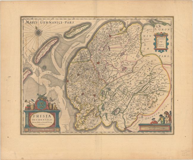
This lovely map of the province of Friesland shows the county divisions, fortified cities, small settlements, and roads, as well as lakes and rivers. The Frisian islands of Ameland, Terschelling and Vlieland form the separation of the Waddenzee and the North Sea. In the lower left is a decorative title cartouche with the Frisian shield flanked by agricultural tools. A nice compass rose, a legend, and a scale of miles with surveyors and horses complete the composition. French text on verso, published between 1643-50.
References: Van der Krogt (Vol. I) #3900:2.2.
Condition: B+
A dark impression with full contemporary color on a lightly toned sheet with a jester watermark. There is a crease adjacent to the centerfold at bottom, a bit of color offsetting, and marginal soiling.