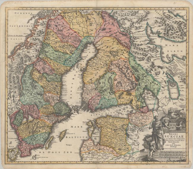
Subject: Scandinavia
Period: 1716 (circa)
Publication:
Color: Hand Color
Size:
22.7 x 19.4 inches
57.7 x 49.3 cm
This detailed map illustrates Sweden, parts of Norway and Finland, and the Baltic states that were at the time under her control, present-day Latvia and Estonia. It was originally published during the Great Northern War (1700-21), a war that pitted the Swedish Empire against a coalition led by the Tsardom of Russia. Scores of towns and villages, rivers and lakes, and islands are located and named. The large decorative title cartouche features the royal coat of arms, a trumpeting angel, putti, and Ares and Minerva.
References:
Condition: B+
A dark impression with full contemporary color and a few manuscript ink notations. There is light dampstaining at center and bottom right, a printer's crease at bottom, and a centerfold separation at bottom that has been repaired with archival materials on verso. A chip in the bottom right margin has been archivally repaired, with a 0.75" section of neatline replaced in facsimile.