Subject: England & Wales
Period: 1823 (dated)
Publication:
Color: Hand Color
Size:
37.4 x 24.4 inches
95 x 62 cm
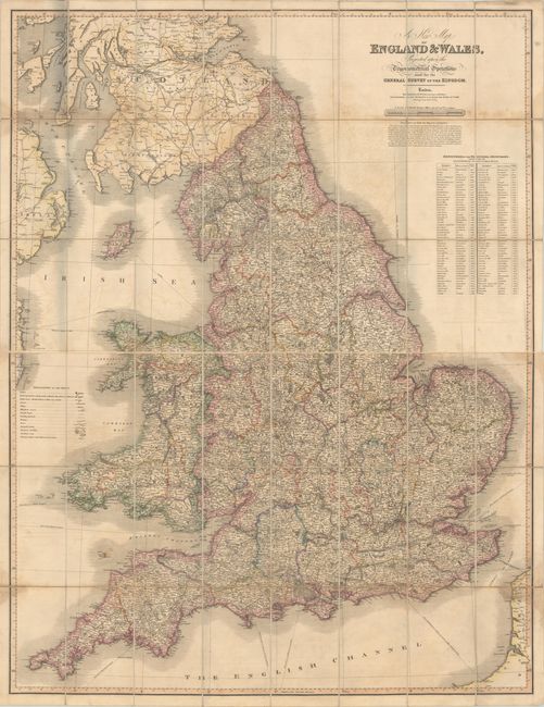
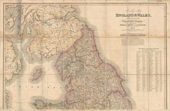
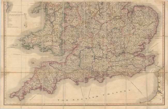
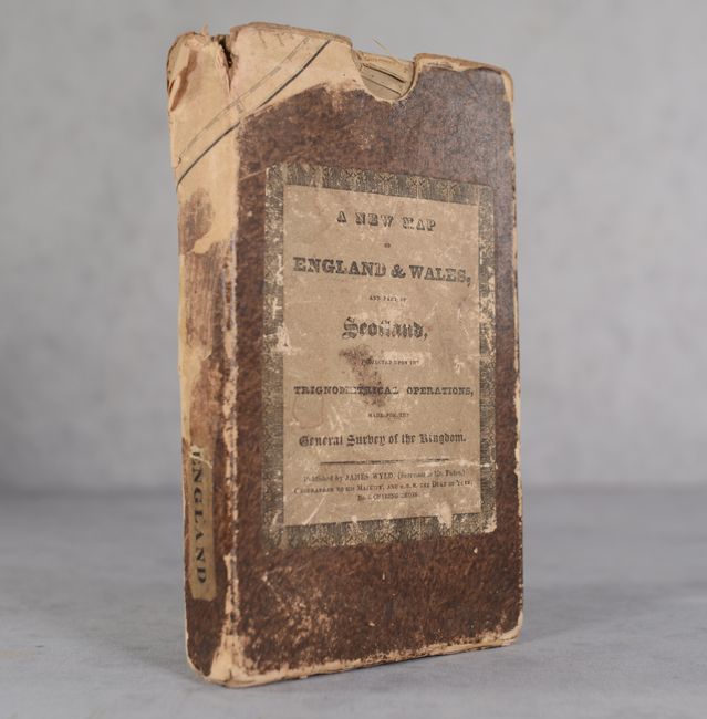
This highly detailed map is delineated by county and covers England and Wales, Scotland north to Perth and the eastern coast of Ireland. Hundreds of cities, towns, and villages are identified along with mail roads, other roads, railroads, canals, "gentlemen's seats" (estates), rivers, mountains, and more. A large table at right presents a detailed listing of the "Altitudes of the Principal Mountains" based upon the trigonometrical survey. Drawn on a scale of 10 miles per inch. Dissected and backed with contemporary linen. Folds into a stiff paper slipcase with title label on the front cover.
References:
Condition: B
Contemporary outline color on sheets that have been dissected and backed with contemporary linen. There is some light toning, offsetting, and minor dampstaining that is more prominent on the northern sheet. Slipcase is chipped and heavily worn. The first image is a composite image - the map is on two separate sheets.