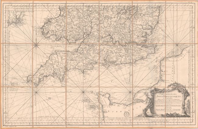
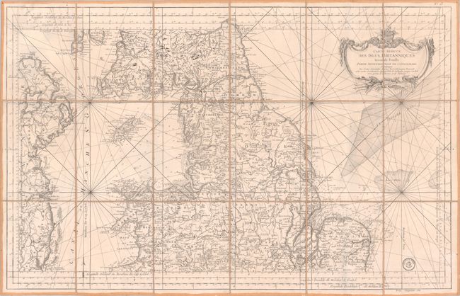
Subject: England & Wales
Period: 1757 (dated)
Publication: Hydrographie Francoise…
Color: Black & White
Size:
35 x 22.2 inches
88.9 x 56.4 cm
These two large-scale charts together cover the entirety of England & Wales in fine detail (part of a five map set of the British Isles). The southern sheet extends as far north as Norwich and Wales and presents the islands of Scilly, Guernsey and Jersey as well as the northern coast of France to Flanders. Locates London, Oxford, Coventry, Cardiff, Lands End, and more. The northern sheet covers the northern part of England, southern Scotland, Wales, the Isle of Man, and the eastern coast of Ireland. Locates the cities of Yarmouth, Norwich, Okcham, Chester, Nottingham, York and Dublin plus scores of smaller towns and villages. The maps are filled with incredible detail, both along the coastline and in the interior including wagon roads, trails, rivers and mountains. Embellished by large decorative title cartouches along with the Depot de la Marine stamp. The price on each is noted as Prix, cinquante sols. Dissected and backed with linen.
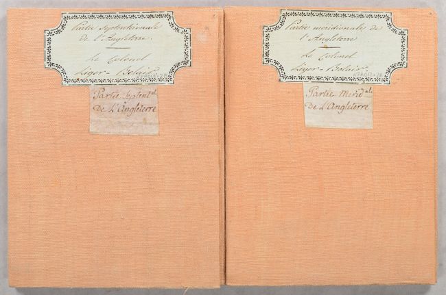
Contemporary manuscript title labels on verso indicate the maps were owned by Colonel (later General) Louis Liger-Belair (1762-1835). Belair joined the French Army in January 1792 as a second lieutenant in the 29th Infantry Regiment. He climbed the military ranks quickly and by 1805 was named Brigadier General. He continued to serve in various capacities under Napoleon until 1813 and again under the Bourbons beginning in 1815.
References:
Condition: A
Crisp impressions on bright sheets with a couple of faint spots. Dissected and backed on contemporary linen with paper title labels on verso.