Subject: Europe
Period: 1854 (dated)
Publication:
Color: Hand Color
Size:
39.3 x 32.5 inches
99.8 x 82.6 cm
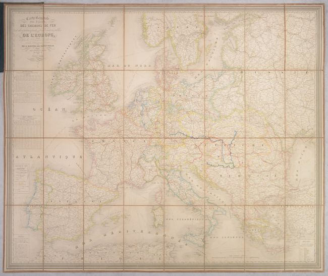
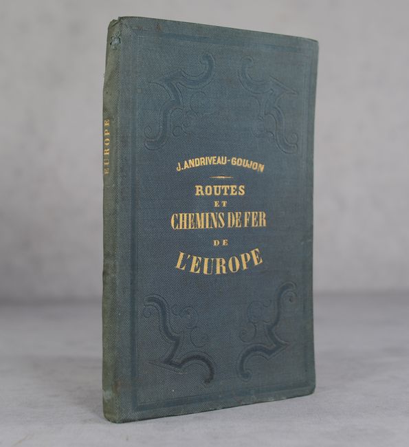
This large dissected and linen-backed folding map is filled with great detail of the postal routes and railroads throughout Europe. There are interesting political boundaries, with the Austrian Empire encompassing much of central and eastern Europe, the Kingdom of Prussia extending through Germany and much of Poland, and the Balkans forming part of the Ottoman Empire. A legend at left identifies the main postal line, roads, completed railroads, railroads in progress, and canals. In addition to the legend, there are two distance tables, a table of distance scales used by various countries, and a list of abbreviations. Engraved by P. Rousset. Folds into green cloth boards with gilt title on the front cover and spine.
References:
Condition: B+
Contemporary outline color on a sheet that has been dissected and backed with contemporary linen. There is some light toning and minor foxing. Covers have minor wear and a bit of residue on the back cover.