Subject: Europe
Period: 1805 (dated)
Publication:
Color: Hand Color
Size:
48.4 x 39.6 inches
122.9 x 100.6 cm
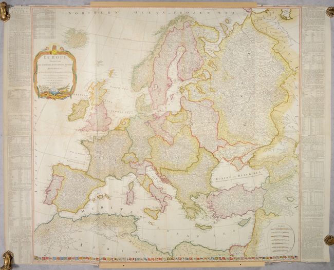
This is Kitchin's version of Robert de Vaugondy's detailed four-sheet map of Europe. Germany, Poland, Hungary and Turkey encompass nearly all of central and eastern Europe. Named places are shown in abundance and boundaries are included. The map includes Iceland above the decorative title cartouche. Tables at sides provide a wealth of information on the major empires, and the flags of all the nations of the world are aligned along the bottom of the map (mostly in alphabetical order), including the United States at far right (with an indeterminable number of stars). This edition was published by Laurie & Whittle. Printed on four sheets, joined.
References:
Condition: B
A nice impression with contemporary color in the map and likely later color in the cartouche and flags. There is light offsetting, a bit of soiling, and several short tears and separations in the sheet that have been archivally repaired on verso. There are a number of small chips and tears along the top and bottom edges of the sheet, some of which enter the map border.