Subject: North Atlantic
Period: 1766 (dated)
Publication:
Color: Black & White
Size:
34.3 x 23.3 inches
87.1 x 59.2 cm
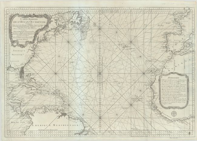
This decorative sea chart of the northern Atlantic Ocean is filled with rhumb lines and detailed scales of latitude and longitude. The coastlines of eastern North America, northern South America, western Europe and western Africa are all depicted with major port cities named.
The coast of North America is labeled with the colonies and Florida is shown as a mass of islands. The rich fishing banks off the northeastern coast of North America, including the Grand Banks of Newfoundland and Georges Bank, are well depicted. Two large, decorative cartouches fill the interior in North America and Africa. This is the fourth edition of a map first produced in 1738 with the Depot de la Marine stamp at lower right.
References:
Condition: B+
A crisp impression on watermarked paper with an archivally repaired 5.5" separation at top, several light abrasions in the upper image, and a few spots of foxing at bottom.