Subject: Canary Islands & Madeira
Period: 1749-80 (circa)
Publication:
Color: Hand Color
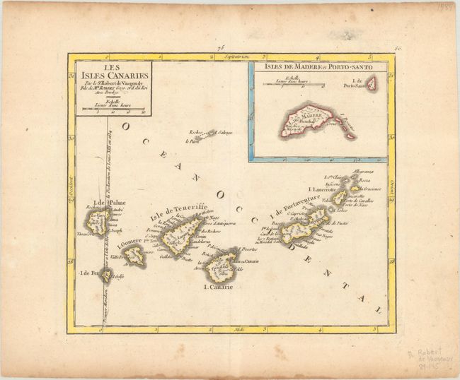
A. Les Isles Canaries, by Didier Robert de Vaugondy, circa 1749 (7.6 x 6.5"). A lovely small map of the Canary Islands showing the Ferro meridian, the line of longitude running through the westernmost of the Canary Islands, which was commonly used as the prime meridian at the time. An inset depicts the islands of Madeira. Reference: Pedley #444. Condition: A watermarked sheet with faint offsetting, light toning along the edges of the sheet, and a few spots of foxing that are mostly confined to the blank margins.
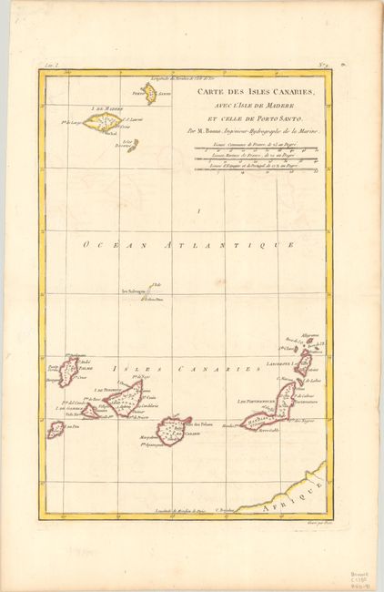
B. Carte des Isles Canaries, avec l'Isle de Madere et celle de Porto Santo, by Rigobert Bonne, from Atlas de Toutes les Parties Connues du Globe Terrestre, circa 1780 (8.3 x 12.6"). This copper engraved map of the Canary Islands includes the islands of Porto Santo, de Madere, Tenerife, Palme, de Fer, de Canarie and Fortaventure. There are three distance scales including French leagues, marine leagues, and Spanish leagues. Condition: A crisp impression with light offsetting and a few small spots of foxing.
References:
Condition: B+
See description above.