Subject: South America
Period: 1842-48 (circa)
Publication:
Color: Hand Color
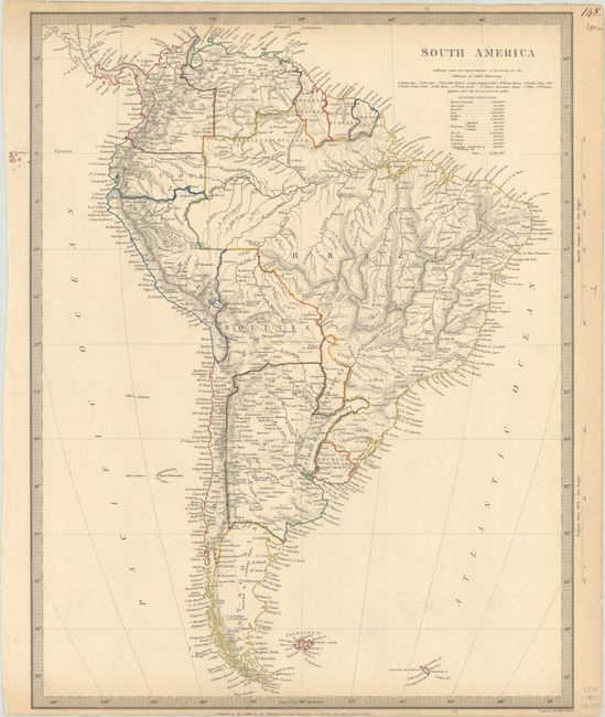
A. South America, by SDUK Society for the Diffusion of Useful Knowledge, dated 1842 (12.6 x 15.6"). This detailed map shows the entire continent, with nations, towns and cities, rivers, and more identified. There is fine topographical detail throughout. The Galapagos appear outside the neatline. According to a note, Patagonia is "Inhabited by wandering Tribes." A table beneath the title shows the estimated populations for the various countries on the continent. Engraved by J. & C. Walker. Condition: Contemporary outline color with three short edge tears that just enter the neatline at top, the longest of which has been closed on verso with archival tape. There is toning along the edges of the sheet and remnants of hinge tape on verso.
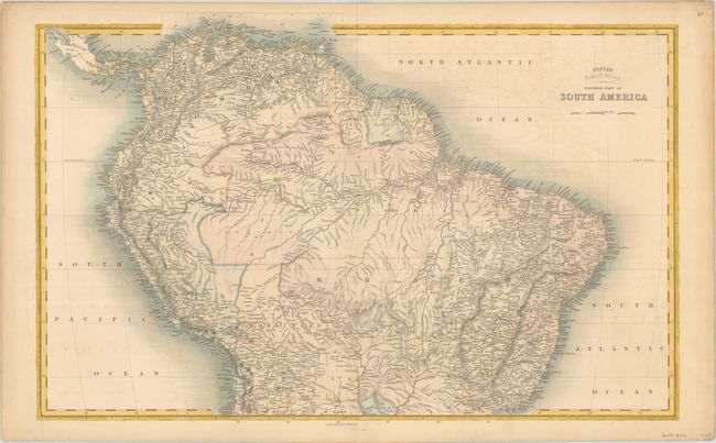
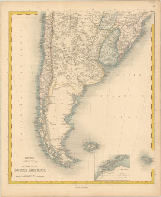
B. Northern Part of South America and Southern Part of South America, by John Betts, from Betts's Family Atlas, published 1848. Matched pair of maps that cover all of South America and provide excellent detail, particularly of the topography. The Northern Part is on double-page (24.3 x 15.6") and the Southern Part is on a single sheet (12.8 x 15.2"). An inset of South Shetland is included on the southern sheet. Condition: Nice impressions on sheets with marginal toning. The northern sheet has faint offsetting and a 7" tear at left that just enters the map border and has been closed on verso with cello tape.
References:
Condition: B+
See description above.