Subject: Guadeloupe
Period: 1850 (circa)
Publication: La France et ses Colonies - Atlas Illustre Cent Cartes...
Color: Hand Color
Size:
8.8 x 7 inches
22.4 x 17.8 cm
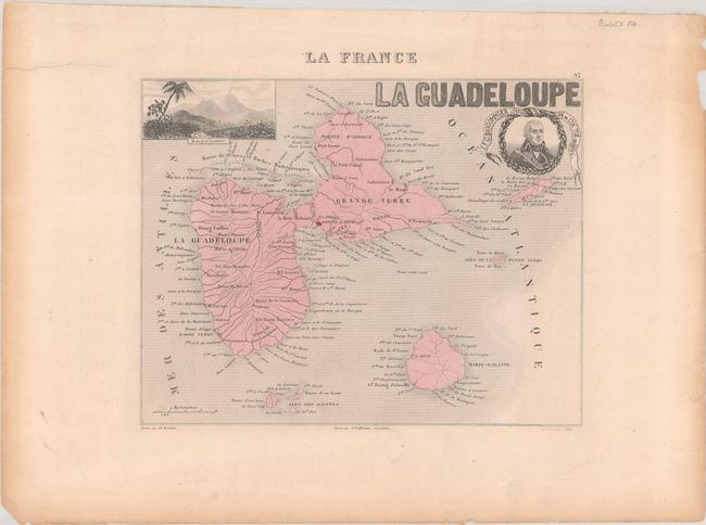
This nicely engraved map of the island group appeared in an atlas published by J. Migeon. The islands are presented simply, with rivers, roads, cities, and place names lining the coasts. At top right is a portrait of Jacques Francois Dugommier, a brigade general in the French Revolutionary Wars who was born in Guadeloupe and fought to defend it during the Seven Years' War. La Grande Soufrière, the active volcano on Basse-Terre, is depicted in a view by Ales at top left. Engraved by Ch. Dyonnet.
References: Rumsey #8774.199.
Condition: B+
On a lightly toned sheet with a 2.5" edge tear in the left margin that has been closed with archival tape on verso.