Subject: Caribbean
Period: 1700 (dated)
Publication: Atlas Novus
Color: Hand Color
Size:
13.6 x 9.1 inches
34.5 x 23.1 cm
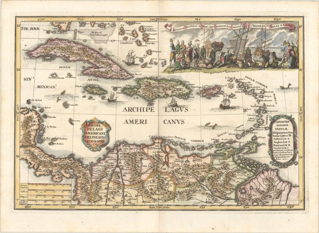
This stunning map is focused on the West Indies, with a portion of Central America and the northern tip of South America. The map features an elaborate view topped with a Latin title that translates roughly to These islands produce fruit and commodities that are transported by ship to Spain, France, and England. The scene depicts traders and merchantmen loading their ships. Heinrich Scherer was a devout Jesuit and many of the maps and plates in his atlas emphasize the Catholic hierarchy and the spread of Jesuit missions throughout the world. Dated 1700, but published in 1703.
References: Shirley (BL Atlases) T.SHER-1a #115.
Condition: A
A sharp impression on a bright sheet with a hint of toning along the centerfold.